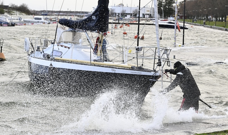
Temperatures were expected to remain between 0°C and -6°C, with light snow showers confined to northern Lapland. However, by Sunday evening, a new weather front sweeped in from the west, bringing widespread precipitation and strong winds.
Initially falling as snow or sleet in southern and central Finland, the precipitation will quickly turn to rain as temperatures rise significantly. By Monday morning, rain is forecast across much of the country, with temperatures reaching up to 10°C in southern regions and the freezing line moving as far north as central Lapland.
Meteorologists predict up to 30 millimetres of rain in western Finland on Monday, equivalent to a month's worth of precipitation in some areas. Combined with the rapid melting of an unusually deep snowpack, this is expected to cause localized flooding.
Last week’s Jari storm left Finland with an extensive snow cover, including record-breaking depths for late November in some areas. Helsinki-Vantaa Airport reported 29 centimetres of snow on 23 November, breaking the previous record of 20 centimetres set in 1960. Hämeenlinna, Pöytyä, and Kokemäki also recorded snow depths exceeding 20 centimetres.
The expected rain and thaw are likely to quickly erode these snowpacks, particularly in southern and central Finland. Forecasters have warned that melting snow and overflowing ditches could flood fields, roads, and underpasses. The Centre for Economic Development, Transport, and the Environment in South Ostrobothnia has already raised its flood warning levels for the region.
Alongside the rain, high winds are expected to accompany the incoming storm. Gusts of 15–20 metres per second are predicted across southern and central Finland on Sunday night and Monday morning. Coastal areas and western maritime regions could see wind speeds nearing storm levels, with localised power outages likely due to falling trees and minor structural damage.
“The situation is not as severe as the Jari storm, but there will still be impacts,” said Joanna Rinne, a meteorologist with Foreca. “There’s a good chance of downed trees and some detached roofing materials in affected areas.”
Meteorologists have advised caution for those travelling on Monday, as roads may be slick with a mixture of slush and rain. Conditions are expected to worsen during the day as thawing snow adds to waterlogged streets and rural pathways.
“Plan extra time if you need to be on the move,” warned Joonas Koskela from Foreca. “It’s a day for waterproof boots and sturdy shoes with good traction.”
In northern Lapland, winter weather is expected to persist, with additional snowfall forecast. Meanwhile, southern Lapland will see a temporary thaw before temperatures drop again later in the week.
As the week progresses, winds are expected to ease, with calmer conditions anticipated by midweek. However, the combination of heavy rain, melting snow, and potential flooding early in the week will keep emergency services on alert.
Officials have urged residents to stay informed through weather updates and take precautions, particularly in flood-prone areas. Temporary measures, such as clearing drainage channels and securing loose outdoor items, may help reduce the impact of the rapidly changing weather.
HT


