


Ireland weather LIVE storm tracker as warnings suddenly upgraded by Met Eireann
Parts of Ireland are set to face severe weather conditions on Sunday as a powerful storm system approaches from the Atlantic. Met Eireann has now issued four alerts, including two Status Orange rain warnings.

Parts of Ireland are in for a battering on Sunday as a severe storm system sweeps in from the Atlantic, bringing with it a forecast of extreme weather conditions.
The storm, which currently has no name, is expected to unleash torrential rain, thunderstorms and gale-force winds, raising concerns about potential flooding, hazardous driving conditions, travel disruptions and the risk of fallen trees.
On Saturday afternoon, Met Eireann issued urgent updates to its weather warnings, resulting in a total of four alerts being put in place ahead of the brutal weather's arrival. These alerts take effect at various times, starting from 5am on Sunday and continuing until 2am on Monday.
Among the alerts are two Status Orange rain warnings - the second highest level possible - as well as two Status Yellow warnings for both wind and rain.
READ MORE: Ireland weather: Monster Atlantic storm prompts ominous 12 hour warning from Met Eireann
READ MORE: Nine electricity myths busted - from leaving heating on low all day to kettle error
Southern and southeastern areas are expected to bear the brunt of the storm. Here's Met Eireann's stormy weather timeline:
- 5am to 8pm - Status Yellow wind and rain warning for Clare, Cork, Kerry, Limerick, Tipperary and Waterford.
It states: "Heavy rain accompanied by strong and gusty winds. Possible impacts include localised flooding, difficult travelling conditions/travel delays, some fallen branches/trees."
- 8am to 6pm - Status Orange rain warning for Cork and Waterford
It states: "Heavy rain with some intense and thundery downpours. Possible impacts include flooding, dangerous driving conditions, travel disruption."
- 12pm to 2am - Status Yellow wind and rain warning for Carlow, Dublin, Kildare, Kilkenny, Laois, Wexford and Wicklow
It states: "Heavy rain accompanied by strong and gusty winds. Possible impacts include localised flooding, difficult travelling conditions/travel delays, some fallen branches/trees."
- 1pm to midnight - Status Orange rain warning for Carlow, Kilkenny and Wexford
It states: "Heavy rain with some intense and thundery downpours. Possible impacts include flooding, dangerous driving conditions, travel disruption."
The overall forecast for tomorrow reads: "Sunday will be wet and windy with widespread rain. The rain will be heaviest in the south and southeast and there will be intense falls at times causing flooding. The rain will also be accompanied by fresh to strong and gusty southeasterly winds, with onshore gales on southern and eastern coasts. Highest temperatures of 10C to 15C. Rain will gradually clear from the southeast on Sunday night, with dry conditions developing across most of the country. However, further outbreaks of rain will move into the northwest later in the night. Lowest temperatures of 8C to 11C with moderate to fresh and gusty east to northeast winds easing and becoming northerly overnight."
You can track exactly when and where to expect rain and thunderstorms below.
You can track exactly when and where windy conditions will hit below.
Those living in the affected counties, particularly those under Status Orange alerts, are being advised to take precautions, stay informed and avoid unnecessary travel during the challenging conditions.
Cork County Council said: "Spells of heavy rain may lead to some localised flooding, poor visibility and difficult driving conditions. Cork County Council’s Severe Weather Assessment Team convened on Friday evening. Crews were deployed on Friday afternoon inspecting known risk locations across the county. Crews will continue to monitor the situation throughout the weekend. Pumping arrangements will be in place in known problem locations.
"The Council is asking members of the public to exercise caution as driving conditions may be dangerous, with surface flooding possible. Motorists are advised to avoid driving through flowing or standing water and to exercise caution during heavy rain. Motorists are also asked to be conscious of cyclists and pedestrians.
"Issues such as flooding and road damage should be reported to the Council’s 'Emergency Out of Hours' number (021) 4800048. Call 999 or 112 and request the Fire Service, Ambulance Service, Gardaí or Irish Coastguard as appropriate. In the event of disruption to water supply, please contact Uisce Éireann at 1800 278 278. Cork County Council will continue to monitor the situation."
Meanwhile, the Road Safety Authority has issued the following advice to motorists:
- Drivers need to slow down and allow a greater braking distance between themselves and the vehicle in front in wet weather conditions. This is especially important on high-speed roads such as dual carriageways and motorways where there is increased danger of aquaplaning.
- Take special care when driving behind goods vehicles, as they generate a considerable amount of spray, which reduces your visibility. Hold back to where you can see their mirrors.
- If the road ahead is flooded, choose another route. Do not attempt to drive through it. Flooded roads that appear shallow could be deeper than you think. The verge may have subsided and there may also be trees or branches that have fallen that may not be visible.
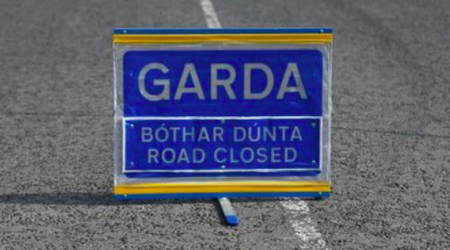
- Road users should always follow recommended routes and obey signs closing roads to traffic that have been put there by the local council or An Garda Síochána.
- After going through water, drive slowly with your foot on the brake pedal for a short distance - this helps to dry the brakes.
- Be Safe. Be Seen. Drive with dipped headlights at all times to ensure that you are visible and that you can see other road users.
- Beware of objects being blown out onto the road. Expect the unexpected.
- Watch out for falling / fallen debris on the road and vehicles veering across the road.
- Control of a vehicle may be affected by strong cross winds. High-sided vehicles and motorcyclists are particularly vulnerable to strong winds
- Drivers should allow extra space between themselves and vulnerable road users such as people cycling and motorcyclists as they may be blown off course by strong winds.
It also issued advice to Pedestrians, people cycling, and motorcyclists:
- Walk on the right-hand side of the road, facing traffic if there are no footpaths.
- People cycling should ensure that they and their bike are visible to other road users by investing in a good set of front and rear lights (white at the front, red at the back) and by wearing clothes that help you be seen on your bike. Consider wearing high visibility material.
- Take extra care when crossing the road or cycling in extremely windy conditions, as a sudden gust of wind could blow you into the path of an oncoming vehicle.
- Be Safe. Be Seen. Visibility and light are reduced in poor weather conditions. Keep safe by making sure you can be seen. Wear bright clothing and consider wearing high visibility material.
Sign up to the Irish Mirror's daily newsletter here and get breaking news and top stories direct to your inbox.
Related


Share this page
Guest Posts by Easy Branches


